About the Journal
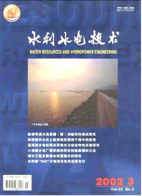
 Journal Title: Water Resources and Hydropower Engineering
Publication Cycle: Monthly(Published on the 20th of each month)
Governing Body: Ministry of Water Resources of the People's Republic of China
Sponsor: Development Research Center of the Ministry of Water Resources
Tel: 010-63205981
E-mail: 13941816@qq.com
China Standard Serial Number (CN): 10-1746/TV
International Standard Serial Number (ISSN): 1000-0860
News
Spatiotemporal evolution of drought-flood patterns in Eastern China over past 550 years and future projections
HUANG Zehong;LIU Jianhua;JIA Zitong;WANG Yichu;YIN Guodong;SONG Rulin;LIU Changming;FU Yongshuo;[Objective] The eastern region of China exhibits high drought-flood variability and faces significant disaster risks.However, the evolution of drought-flood patterns based on long-term historical data remains unclear. The aim is to reveal the long-term evolution and future trends of drought-flood patterns in eastern China. [Methods] Based on long-term meteorological data from 1470 to 2020 in China, a drought-flood level series was reconstructed. Wavelet analysis and power spectrum analysis were applied to identify the dominant cycles and stage characteristics, and a long short-term memory( LSTM) model was employed to predict the drought-flood evolution trends in eastern China from 2030 to 2100. [Results] The result showed that between 1470 and 2020, eastern China experienced two predominantly dry periods and one predominantly wet period. The drought-flood conditions exhibited variation cycles averaging 20, 50, and 180 years. The “wet north-dry south” and “dry northwet south” climate patterns alternated with an average cycle of 200 years. Spatial analysis showed that over the past 50 years,regions such as North China and the southwestern part of Northeast China have high drought-flood variability, with large interannual variance thresholds, indicating an unstable climate system. In contrast, most southern regions exhibited low variability and more stable drought-flood variations. Machine learning prediction result indicated that after the mid-21st century,the climate pattern of eastern China would shift from predominantly dry to predominantly wet. Since the late 20th century, the frequency of “wet north-dry south” events had gradually increased, reaching a phase of high occurrence around 2036, followed by a gradual decline. In contrast, “dry north-wet south” events were expected to gradually intensify afterward, reaching a phase of high occurrence in the mid-21st century before gradually decreasing. [Conclusion] The result indicate that drought-flood conditions and north-south drought-flood patterns in eastern China exhibit long-term periodicity and alternating phases. In the future, the climate system may show a transitional trend from predominantly dry to predominantly wet conditions. These findings deepen the understanding of the spatiotemporal evolution mechanisms of drought and flood in eastern China and provide scientific support for optimizing water resource allocation, assessing drought and flood disaster risks, and constructing defense systems.This is of great significance for ensuring regional water security.
Review of detection methods for water ice at lunar south pole
ZHANG Dashuai;QU Peiliang;ZONG Zhongling;ZHAO Honghua;XIE Qinghai;MENG Jinxin;Jiangsu Ocean University;[Objective]The permanently shadowed regions(PSRs) at the lunar south pole, due to their low temperatures and prolonged absence of sunlight, have become key reservoirs for lunar water ice. Clarifying the distribution, abundance, and form of occurrence of water ice in this region is a core scientific question for understanding the origin and evolution of lunar water sources. It is also a critical prerequisite for enabling in-situ resource utilization and sustainable deep space exploration on the Moon. [Methods]Existing research method include orbital remote sensing technologies and indirect analytical techniques. In terms of orbital remote sensing, neutron and gamma-ray spectroscopy, near-infrared and thermal infrared spectroscopy, and radar polarimetric imaging techniques are applied to analyze their principles and detection capabilities. For indirect analysis, methods such as impact plume analysis, thermal environment modeling, and micro-cold trap analysis are employed to evaluate the stability of water ice. [Results]In-situ drilling and thermal gas release analysis have been established as the final verification techniques for the presence of water ice. Through data analysis from missions such as Lunar Prospector, Chandrayaan-1, Lunar Reconnaissance Orbiter, and LCROSS, the accuracy, applicable scenarios, and limitations of different detection method are evaluated, revealing differences in their performance in detecting the distribution of water ice. [Conclusion] The future directions of technological development include breakthroughs in high-spatial-resolution remote sensing technologies to improve the accuracy of water ice distribution mapping; the development of lunar surface mobile robots equipped with autonomous navigation and precise sampling capabilities to support in-situ exploration in complex terrains; and the establishment of an “orbital-in-situ-simulation” multi-scale data fusion framework. This will form a comprehensive understanding of lunar water ice from macroscopic distribution to microscopic mechanisms, thereby providing technical support for lunar base construction and deep space exploration.
Study on coordinated water supply scheduling of reservoir groups during dry season in Yuanhe River Basin based on MIKE Basin model
WEN Tianfu;ZOU Zhu;YOU Jinjun;ZHAO Nanfang;MA Zhenzhen;LIU Xin;Jiangxi Academy of Water Science and Engineering;Jiangxi Key Laboratory of Flood and Drought Disaster Defense;[Objective]In 2022, the Poyang Lake Basin experienced a rare drought event with consecutive summer and autumn aridity and extremely low water levels during the flood season, leading to sustained declines in river and reservoir water levels.Implementing coordinated water supply scheduling for the reservoir groups in the basin can alleviate the prominent imbalance between water supply and demand. [Methods] Taking the Yuanhe River Basin( a tributary of the Ganjiang River) as an example, 10 key water supply projects and 30 critical water supply targets were selected. A coordinated water supply scheduling model for reservoirs in the basin was established using the MIKE Basin model. Coordinated water supply regulation measures for reservoirs were proposed, and the water supply scheduling effects in the basin were analyzed. [Results]In typical years such as 2001, 2007, and 2022, six water consumers in the Yuanhe River Basin, including the Shankouyan irrigation area, Yuanhe Water Plant, Feijiantan irrigation area, Yuannan irrigation area, Yuanhuiqu irrigation area, and Menghe irrigation area,experienced water shortages with water shortage rates ranging from 0. 2% to 28. 9%. After implementing three regulation measures, including adjusting the limit water levels of water supply for Shankouyan, Feijiantan, and Jiangkou reservoirs,adjusting the water supply targets for Shankouyan reservoir, and adding new reservoir projects, the water shortage levels of the main water consumers significantly improved, achieving an average 7. 2% reduction in water shortage. Under three inflow frequencies of 90%, 95%, and 99%, the water shortage rates for Shankouyan irrigation area, Feijiantan irrigation area, and Yuanhuiqu irrigation area decreased by an average of 7. 41%, 3. 46%, and 2. 28%, respectively. [Conclusion] Based on the actual water shortage conditions, reasonable reservoir regulation measures are proposed, which effectively improves the water shortage levels of major water consumers, such as irrigation areas in the dry season. These measures can provide technical support for the response to extreme drought events in river basins.
Variation and propagation characteristics of meteorological and hydrological droughts in Longitudinal Range-Gorge Region
CHEN Wenhua;LI Wenjin;ZHANG Ning;FENG Chunhong;LI Guoyong;CHEN Kai;[Objective] Global climate change and human activities have profoundly altered drought dynamics, particularly in ecologically sensitive regions. This study analyzes the propagation characteristics and mechanisms of meteorological drought(MD) and hydrological drought(HD) on both sides of the southern Gaoligong Mountains within the Longitudinal Range-Gorge Region( LRGR), aiming to provide scientific foundation for effective water resource management and disaster prevention.[Methods]Based on the significant hydrometeorological differentiation between both sides of the southern Gaoligong Mountains,and using monthly precipitation and runoff data between 1981 and 2020 from representative river basins, the intensity and frequency of MD and HD were evaluated using the standardized precipitation index(SPI) and standardized runoff index(SRI).Variation trends of drought indices were analyzed through Mann-Kendall trend tests. Run theory was employed to evaluate the propagation time lag from MD to HD, followed by a Bayesian ordinal probit regression model to quantify the relationship between cumulative precipitation deficits(SPIm) and HD severity. [Results] The result showed that over the past four decades, MD intensity in the LRGR had increased significantly. The frequency of MD events( approximately 2. 2 to 2. 5 events/year) was notably higher than that of HD events(approximately 1. 1 to 1. 5 events/year). HD events demonstrated longer duration(2. 18 to 3. 04 months) and greater severity(1. 18 to 1. 76). The propagation from MD to HD was relatively rapid, with an average time lag of 0. 5 to 0. 7 months, while the recovery process showed longer lags(1. 2 to 2. 2 months). The Bayesian analysis revealed a negative correlation between SPIm and HD severity, with increased uncertainty in this relationship under extreme MD conditions.[Conclusion]High-intensity HD may constrain agricultural and socio-economic activities in the region. The rapid response to MD and the prolonged HD recovery highlight emerging challenges for sustainable water resource utilization in this area. These findings enhance the understanding of drought propagation processes in mountainous ecosystems and provide scientific support for adapting water resource management strategies to climate change.
The temporal and spatial evolution of drought-flood abrupt alternation in the Shanmei Reservoir Basin under climate change
ZHANG Yuanjie;SONG Tieyan;CHEN Ying;CHEN Xingwei;GAO Lu;LIU Meibing;DENG Haijun;[Objective]The Shanmei Reservoir Basin, located in a subtropical monsoon climate zone, is frequently affected by tropical cyclones, subtropical high-pressure systems, and complex topography, leading to frequent drought-flood abrupt alternation(DFAA) events that severely threaten regional water security. Accurately identifying and predicting the spatiotemporal evolution of DFAA under global change is crucial for regional disaster prevention and mitigation. [Methods]Shanmei Reservoir Basin was taken as study area. Using the Standardized Precipitation Index with a 12-day antecedent precipitation period(SPI-12d), the spatiotemporal characteristics of DFAA from 1980 to 2018 were analyzed. Additionally, CMIP6 multi-model ensemble projections under SSP2-4. 5 and SSP5-8. 5 scenarios were employed to predict the spatiotemporal evolution of DFAA in the 21st century. [Results] Key findings include:(1) The frequency of drought-to-flood(DTF) and flood-to-drought(FTD) events initially increased significantly and then decreased gradually. DTF intensity rose significantly, while FTD intensity declined. DTF events were concentrated in January, July, and September-December, whereas FTD events mainly occurred from August to November.(2) High-frequency and high-intensity DTF areas were located in the southern watershed, while high-frequency FTD areas were in the northeast and high-intensity FTD areas in the southeast.( 3) Future projections indicate increasing DTF frequency and intensity, with greater increases under SSP5-8. 5. FTD frequency showed insignificant declines under SSP2-4. 5and slight rises under SSP5-8. 5, while FTD intensity decreased. DTF increases were most pronounced in February and December, whereas FTD increases were notable in January, August, and October.(4) The central and southern watershed will face higher risks, with both DTF and FTD frequency and intensity projected to increase. [Conclusion] DFAA impacts in the Shanmei Reservoir Basin are intensifying overall, with the central-southern region as a high-risk zone. DTF poses a greater threat than FTD. These findings provide a scientific basis for DFAA monitoring and response.


Online System
Tracking the information about your manuscript
Communicate with the editorial office
Query manuscript payment status Edit officeCollecting, editing, reviewing and other affairs offices
Managing manuscripts
Managing author information and external review Expert Information Expert officeOnline Review
Online Communication with the Editorial Department
Download
Example of Manuscript Modification Description Document
Invitation for Reviewers
Chinese Manuscript Template in Regular Issue
Copyright Assignment Agreement and Academic Specification Commitment
Manuscript Template in Supplement
Submission FAQ
English Manuscript Template in Regular Issue
2022—2023 Journal Catalogue

