About the Journal
 Journal Title: Water Resources and Hydropower Engineering
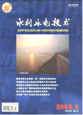
Publication Cycle: Monthly(Published on the 20th of each month)
Governing Body: Ministry of Water Resources of the People's Republic of China
Sponsor: Development Research Center of the Ministry of Water Resources
Tel: 010-63205981
E-mail: 13941816@qq.com
China Standard Serial Number (CN): 10-1746/TV
International Standard Serial Number (ISSN): 1000-0860
News
Analysis of evolutionary characteristics and causes of drought-flood abrupt alternation in middle and lower reaches of Yangtze River Basin
WANG Li;XIA Huan;YUAN Zhe;SHI Xiaoliang;LI Zhiyi;HU Jing;XU Liang;[Objective]Under the influence of the subtropical monsoon climate, drought-flood abrupt alternation(DFAA) events frequently occur in the middle and lower reaches of the Yangtze River Basin(MLRYRB), posing a serious threat to the sustainable development of the river basin. Therefore, accurately identifying and analyzing the evolution patterns and causes of DFAA events is of great significance for formulating regional disaster prevention and mitigation strategies.[Methods]The short-cycle drought-flood abrupt alternation index(SDFAI) was employed as an indicator for identifying DFAA events to examine the spatiotemporal characteristics of drought-to-flood(DTF) and flood-to-drought(FTD) events in the middle and lower reaches of the Yangtze River, including their frequency, spatial extent, and intensity. Furthermore, the multiscale geographically weighted regression(MGWR) model and the random forest(RF) model were used to quantify the meteorological and atmospheric circulation factors of DFAA events.[Results]The result showed that:(1) DTF and FTD events occurred alternately, with the annual maximum intensity of DTF events showing a decreasing trend and that of FTD events showing an increasing trend, indicating a shift from DTF-dominated to FTD-dominated patterns.(2) The number of occurrences of both DTF and FTD events was primarily concentrated between 22 and 26 times, with the slight events exhibiting the broadest spatial extent and moderate-intensity events being the most frequent. Spatially, western Hunan, southern Anhui, and southern Jiangsu were DTF-prone areas, while southern Hunan and southern Hubei were more susceptible to FTD events.(3) Temperature(TRE) and precipitation(PRE) were the dominant meteorological drivers of DFAA events, serving as the primary or secondary influencing factors in more than 50% of the region. However, sunshine duration(SSD) was the primary influencing factor for FTD events in 29.12% of the region. The El Ni1o-Southern Oscillation(ENSO)and Sunspot were the major atmospheric circulation factors influencing DFAA events.[Conclusion]Compared to FTD events, DTF events exhibited greater intensity, frequency, and spatial extent in the MLRYRB. Hunan, central Hubei, and southern Anhui are regions with frequent occurrences of DFAA events. TEM and PRE are the dominant meteorological drivers of DFAA events, while the ENSO and Sunspot were the key atmospheric circulation factors. These findings can provide scientific guidance for improving the monitoring, prediction, and management of DFAA events in this region.
Spatiotemporal evolution characteristics of compound drought and heatwave events in Dongting Lake Basin
RUAN Huixing;DENG Yu;OU Zhou;WANG Xuan;LIN Jingbo;YANG Peng;DENG Haijun;[Objective]In the context of global climate warming, extreme weather events occur with increasing frequency in the Dongting Lake Basin, and compound drought and heatwave events(CDHEs) exacerbate their influence on socioeconomy and the ecological environment. Analyzing the spatiotemporal evolution patterns of the CDHEs in the Dongting Lake Basin and their response to atmospheric circulation factors is of great significance for regional disaster prevention and mitigation.[Methods]Based on daily maximum temperatures, Standardized Precipitation Evapotranspiration Index(SPEI), and atmospheric circulation indices from 1971 to 2020, trend analysis and wavelet coherence analysis were employed to analyze the spatiotemporal evolution patterns and atmospheric circulation driving mechanisms of CDHEs in the Dongting Lake Basin.[Results]The results showed that from 1971 to 2020, the annual maximum daily temperature in the Dongting Lake Basin showed a significant increasing trend, with a rate of 0.28 ℃/10 a. The SPEI showed substantial interannual fluctuations, with no clear pattern. Droughts were relatively frequent and persistent, occurring during 1983—1988 and 2003—2009. The number of days and duration of CDHEs in the river basin demonstrated increasing trends, with the number of days increasing at rates of 2.2 d/10 a, 1.3 d/10 a, 0.3 d/10 a, and the duration increasing at 0.9 d/10 a, 0.6 d/10 a, 0.2 d/10 a, respectively, exhibiting significant interdecadal variation characteristics. Seasonally, CDHEs mainly occurred in July and August. In the latter 25 years, the number of days and duration of these events increased compared to the former 25 years. Spatial frequency variations exhibited an “increase in the east and decrease in the west” pattern. The northeastern region showed the most significant increase, exceeding 200%. The frequency of CDHEs was influenced by multi-scale atmospheric circulation factors, among which the El Ni1o-Southern Oscillation(ENSO), Pacific Decadal Oscillation(PDO), North Atlantic Oscillation(NAO), and Western Pacific Subtropical High(WPSH) demonstrated more significant influence.[Conclusion]From 1971 to 2020, the number of days and duration of CDHEs in the Dongting Lake Basin showed increasing trends, with significant spatial distribution differences. An overall increasing trend was observed in the east, while the decreasing areas were mainly located in the west. Atmospheric circulation factors such as ENSO, PDO, and NAO were important influencing factors of the occurrence of CDHEs. These findings provide a scientific basis for regional compound disaster risk assessment and adaptive management.
Low-cost early warning for direct drinking water pipeline leakage based on SMOTE-ENN-GWO-SVM model
WANG Pengyuan;LIU Zhixue;GUO Guangfeng;LIU Baowei;DU Shuaishuai;LIU Ying;[Objective]Leakage in direct drinking water pipelines has long been a persistent challenge in China's water supply industry. It not only affects residents' normal water usage but also leads to substantial drinking water waste and brings significant economic losses to water supply enterprises. Current leakage detection technologies face challenges such as high equipment costs, insufficient intelligence levels, and imbalanced data categories.[Methods]To address these issues, a low-cost pipeline leakage early warning model based on the principle of constant pressure water supply was proposed. Building upon the principle of constant pressure water supply, the dynamic changes in operational parameters of water supply frequency converter, such as frequency, voltage, current, and rotational speed, were used to establish the SMOTE-ENN-GWO-SVM leakage early warning model by integrating intelligent algorithms and machine learning technologies. The SMOTE algorithm was used to perform oversampling on the sample data to balance the class distribution, the Edited Nearest Neighbors(ENN) algorithm was applied to clean noisy samples, and the grey wolf optimizer was used to adjust the key hyperparameters of the support vector machine(SVM) to enhance model performance.[Results]The result showed that the SMOTE-ENN-GWO-SVM model achieved an accuracy of 98.16% and an F1 score of 0.952 3, both outperforming the comparative models.[Conclusion]This method significantly improves the accuracy and robustness of leakage detection. Its characteristics of low cost and high precision meet the practical application requirements for responsive and reliable leakage detection in direct drinking water systems, providing technical support for improving the efficiency of urban water resource management.
Long-term optimized scheduling of hydro-wind-PV complementary systems considering extreme new energy output events
YAN Jingjing;WANG Zhenni;WEN Xin;LIU Zhehua;[Objective]To address the risks of power shortage or water abandonment in hydro-wind-PV complementary systems under continuous extreme new energy output events, and to coordinate the mid-term scheduling risks and long-term power generation benefits of the system, a long-term optimized scheduling method for hydro-wind-PV complementarity considering extreme new energy output is proposed.[Methods]First, extreme new energy output scenarios were defined, and samples were extracted from multi-year historical data to reveal the characteristics of extreme new energy output. Second, a scheduling risk assessment method for hydro-wind-PV systems under extreme new energy scenarios was developed. Finally, a multi-objective optimization model for hydro-wind-PV complementarity was established, considering both power generation and scheduling risks to enhance the system's response capability to extreme new energy events, and it was validated using the Beipan River Clean Energy Base as a case study.[Results]The result showed that taking a normal year as an example, before optimization, the maximum power shortage risk reached 0.75×10⁸ kWh in the pre-flood stage, while the maximum power curtailment risk reached 0.31×10⁸ kWh in the post-flood stage. Compared with the power-generation-optimal solution, the balanced scheme reduced scheduling risk by 0.48×10⁸ kWh and decreased power generation by 0.17×10⁸ kWh. Compared with the risk-optimal solution, the balanced scheme increased scheduling risk by 0.21×10⁸ kWh while improving power generation by 0.66×10⁸ kWh. The proposed model recommended controlling the water level of Guangzhao Reservoir within 692.15~694.93 m in the pre-flood stage and 743.84~745.00 m in the post-flood stage.[Conclusion]The hydro-wind-PV system shows significant limitations in flexible regulation performance. The proposed multi-objective optimization model can effectively coordinate power generation benefits and scheduling risks under extreme new energy scenarios. The key-node water level intervals corresponding to the Pareto front set can serve as reasonable water level control ranges. The balanced scheme demonstrates excellent performance in balancing power generation benefits and risk control and achieves a significant reduction in scheduling risks at the expense of only a small loss in generation, thereby providing valuable guidance for formulating scheduling strategies against extreme new energy output.
Study on climate change and hydrological response characteristics on northern slope of Kunlun Mountains
ZHAO Qi;SHI Xuexia;ZHANG Liang;PANG Ning;GU Xinchen;Xinjiang Uygur Autonomous Region Hydrological Analysis and Computation Center;Xinjiang Vocational University;[Objective]Due to the complexity of high-altitude environments and the combined effects of climate change and human activities, the mechanisms of runoff variations on the northern slope of the Kunlun Mountains have become one of the core challenges in current hydrological research in arid regions. The coordinated evolution patterns of climatic and hydrological processes on the northern slope of the Kunlun Mountains(covering Hotan River, Keriya River, and Cherchen River basins) from 1956 to 2023, as well as their underlying influencing factors, are investigated, aiming to provide decision-making support for the sustainable management and scientific allocation of water resources in cold and arid regions.[Methods]Based on high-resolution meteorological and hydrological databases, and combining methods including linear regression analysis, moving average analysis, and anomaly analysis, the long-term trends, spatial clustering, and driving mechanisms of regional temperature, precipitation, and runoff were revealed.[Results]The results indicated that(1) the region showed significant accelerated warming, with a warming rate of 0.313~0.375 ℃/10 years, significantly higher than the global and national average values. It was primarily driven by the elevation-dependent warming effect and the decrease in surface albedo caused by snow and ice melting.(2) Precipitation generally exhibited a linear increasing trend(1.17~11.8 mm/10 years), but due to the weakening of westerly moisture transport, precipitation in the eastern region shifted to a decreasing trend after 2020.(3) Runoff increased significantly after the 1990 s(with an increase of over 30% after 2010). Decoupling analysis based on Z-score standardization confirmed that temperature contributed far more to runoff than precipitation. Runoff primarily depended on short-term replenishment from accelerated glacial melting, showing a high degree of synchrony with temperature changes, whereas the precipitation-runoff response exhibited a lag, which might be related to groundwater storage and regulation.(4) Hydrological responses differed significantly between the eastern and western regions. The precipitation-to-runoff conversion efficiency remained stable in western river basins, whereas that in eastern river basins experienced distinct decoupling after 2020.[Conclusion]The northern slope of the Kunlun Mountains shows an extreme “temperature-controlled” response pathway, and climate change has significantly reshaped the regional hydrological patterns. Therefore, it is necessary to develop a monitoring and early warning system targeting peak glacial melting, revise water conservancy engineering standards, and optimize water resource allocation strategies, so as to cope with future runoff decline risks and ensure regional water and ecological security.


Online System
Tracking the information about your manuscript
Communicate with the editorial office
Query manuscript payment status Edit officeCollecting, editing, reviewing and other affairs offices
Managing manuscripts
Managing author information and external review Expert Information Expert officeOnline Review
Online Communication with the Editorial Department
Download
Example of Manuscript Modification Description Document
Invitation for Reviewers
Chinese Manuscript Template in Regular Issue
Copyright Assignment Agreement and Academic Specification Commitment
Manuscript Template in Supplement
Submission FAQ
English Manuscript Template in Regular Issue
2022—2023 Journal Catalogue

